Showing posts with label Ontario. Show all posts

Monday, August 29, 2016

Review: Rossport Campground, Rainbow Falls Provincial Park

View from one of the spectacular waterfront sites
at Rossport Campground
Location: 2 hours E of Thunder Bay; 5 hours NW of Sault Ste. Marie
Website: Ontario Parks 
Map: Google
Camping Facilities: Frontcountry / Car Camping
Grade: C+
Stargazing: Good
Summary: Some nice car camping with lake-front campsites, even though it's right on the highway.
Thoughts: Well it served me right for not doing too much research. I had planned to do some backcountry camping in Sleeping Giant PP, so that I could spend the afternoon enjoying its fantastic hiking trails. It turns out that the backcountry camping required a substantial chunk of hiking just to get set up. In fact, from what I could see, it was a 5 km hike just to get into the sites (I've included the backcountry map below - I really wish that Ontario Parks would post these on their website!), which was too far for one night IMHO. So I had to bail on my camping plans and settle for the bumpy drive up to the lookout over Thunder Bay (which is unreal! you have to check it out!).

A nice spot to stargaze if the skies cooperate

So I did the 2 hour drive down to Rainbow Falls instead, and it was a good thing as it would have been pretty miserable drive to Lake Superior PP the next day if I hadn't. I arrived pretty late at Rainbow Falls, getting close to supper time. I had the choice between the Rossport Campground (which is right on Lake Superior) and the Whitesand Lake Campground. So essentially, your choice is a view over shrubbery or a view over Lake Superior - it's an easy one to make. I drove around Whitesand just in case there were some nice ones that actually overlook the lake, but couldn't find any (at least, none that were available), so I just headed back to Rossport.

First lookout on Rainbow Falls trail
The check-in at the gate was typical Ontario Parks - friendly, helpful, trying to make sure you get the camping experience you're after. At both gatehouses they insisted that I roam around and have a look for a site that I like best. (Aside: this is something that will only happen in less busy parks - in Bon Echo or Pinery, you pretty well take what they have, because your site will probably be gone by the time you get back to the gatehouse). Highway noise is again an issue, but that's the price of convenience. I mean, pulling over and camping next to Gitchigumi with no reservation in peak of summer for about $40 - you can make do.

Sure, it's loud but a primo seat for
watching thundering water
A few of the sites afford a fantastic view of Lake Superior as they are right on the shore; but I must say, there are only about 4 high quality sites, and the campsites that are not adjacent to the lake were not very good. Even still some of the sites next to the lake were not actually on the water - in fact, the lake wasn't even accessible for a few of these. However, many of those sites had good under story for privacy though astoundingly, these were sometimes positioned directly across from one another (hello privacy...so long privacy).


Blueberries in various
stages of development
Rainbow Falls -
photos do not do it justice!
The following day I ventured up to the hike to Rainbow Falls (fantastic) in the Whitesand Lake campground, followed by the two lookouts (which were well worth it, mainly because of all the wild blueberries near the lookouts!). I recommend the hikes, the thundering water of Rainbow Falls takes no time to reach and will keep you entertained for a while (especially if try out your best Ansel Adams impersonation).


Sleeping Giant Backcountry Hiking Map
Backcountry map of Sleeping Giant Provincial Park
(circa 2015)

Friday, February 12, 2016

Review: Hattie Cove Campground, Pukaskwa National Park

Playter Harbour, Coastal Hiking Trail
Location: Hattie Cove Campground, Pukaskwa National Park
Website: Parks Canada
Map: Parks Canada
Camping Facilities: Car Camping
Grade: B
Stargazing: Good by the Lake
Summary:Average camping enhanced by being close to glorious Lake Superior and pristine forest setting
Thoughts: The plan was to make my way along the Trans Canada highway towards Thunder Bay, aiming to meet up with some friends along the drive for some camping. I originally had Slate Islands Provincial Park in mind, after reading this article about it's dense elk population (imagine having elk roaming through your site). I was stoked, but then I found out it would cost $500 for a return shuttle from Terrance Bay. Split between 6 couples for one week, you could make a strong case for it. But with just 3 people staying only one night, it would be a total waste. So my friends suggested Pukaskwa (pronounced Puck-a-Saw, as I quickly found out). I had been meaning to see it for quite some time, and figured that it's a low-stress option to enjoy the company of old friends whom I hadn't seen in a while.

Lookout over Halfway Lake
The camping itself was just okay. Some sites are a little more private than others; you'll find that some are inexplicably directly across from one another, with only your cars to provide the necessary screen to avoid any awkward eye contact. But a few sites are large and pretty private. I wanted to see 48, which is a bit off the road and sits next to Halfway Lake, but it was occupied and I was told it's a bit buggy (you can see in the photo on the right that Halfway Lake is a bit swampy). Site 46 would be a winner if it weren't clearly visible from the path to the comfort station. Speaking of which, the comfort stations in the park are clean and comfortable. And as with all National Parks, you pay twice - the entrance "day-use" fee and the camping fee - which I find a bit irritating, but it still ends up being cheaper than car camping in Ontario Parks (by about $3 - 2015 fees). The park staff I dealt with were really thoughtful and allow you to take a drive around to see what site you like best, then register after you've had a gander. You're likely to find something good, but yea, nothing special.

Middle Beach, with it's piles of driftwood
But putting the camping aside, the setting of the park itself is phenomenal. Just a short 5 minute walk from the campground, you're on Lake Superior, with its thunderous waves drowning out any thoughts of the real world that might have followed you on your trip. You could stare at the Lake for hours, watching it play Hot Potato with the beach, as the waves toss the driftwood to the beach and the beach rolls it right back. And at night you'll find that the Middle and North Beaches (probably Horseshoe Beach too) are spectacular for stargazing. The day hikes to Manito Mikana, Horseshoe Beach, and the Southern Headland Trail are all well worth the trip and you'll be entranced by the vistas. I thought the lookout over Halfway Lake (above) was worthwhile (just after you start a counterclockwise tour from the trailhead), but the rest of the hike looked a bit boring so I skipped it. Please correct me if I'm wrong.

Boardwalk at the beginning of the
Pukaskwa Coastal Hiking Trail
The highlight of the park is the Coastal Hiking Trail. With its many campsites and nearly pristine Lake Superior coastal scenery, it is a worthy adventure. There is justification for the use the word "pristine", as you can see from this map that Pukaskwa is one of the last remaining intact forest landscapes in the southern half of the province, as discovered by the IFL mapping team. I was only able to hike to the first campsite, but even that one (Playter Harbour) was something to behold (top of the page here). The backcountry site itself was really spacious, with an outhouse, fire pit and food locker. I'm curious about the other sites, as they contain up to six individual sites - are these clustered together? Or are they somewhat private? Please comment below if you know. As well, I should point out that the trail is well marked and easy to follow, but would be very slippery in spots after a bit of rain.

Lookout from Southern Headland Trail
I'd love to come back and at least make it to the White River Suspension bridge, but it's a full day hike (leave before 10am). A fellow hiker informed me that he wanted to do a one-way hike and get a shuttle back from the North Swallow river, but the guiding company was going to charge him $500 for the trip back so he just walked the whole stretch in a return trip (solo no less!). What is it with $500 shuttling fees in this part of the province? Regardless, Pukaskwa is worth your effort because it's just a beautiful spot - the camping is a means to discover the splendor of this unique wilderness refuge.

Food locker on the
Coastal Hiking Trail
Outhouse on the Coastal Hiking Trail


.


Review: Canoe-in Sites, Grundy Lake, Grundy Lake Provincial Park

grundy lake provincial park
Backcountry Site Map of Grundy Lake
 (From Park Tabloid, 2005)
Location:  80 km N of Parry Sound
Website: Ontario Parks
Map: Google Maps
Camping Facilities: Car Camping with some pseudo backcountry
Grade: B-
Stargazing: Good, in fact we saw the Northern Lights each time visit.
Summary: Some very easy-to-access backcountry but some sites close to beaches & railroad, eliminating any sense of wilderness
Thoughts: A last-minute interior camping trip from Toronto in August can be a challenging thing to arrange. Joeperry? Full. Frontenac? Full. Killarney? Full. Canisbay? Full. However, there's always Grundy lake; the paddle-in sites are non-reservable (first come, first served basis), and there are often plenty of sites available (twice I've found sites in the middle of the peak season, even on a Labour Day weekend).

Site 119 on Grundy Lake
Like I said in my review for Gurd Lake, Grundy's sites have it all:  short paddles, easy access, some isolation, nice sites, and its reasonably quiet. I would say that Gurd offers a bit more privacy than Grundy, as we found that Grundy is shared with both "backcountry" campers and car campers. But the fishing must be great on Grundy, because there were so many people out exploring the lake by canoe and kayak. Not that it's all that bothersome, since they aren't motorboats. But yea, expect lots of traffic. After nightfall though, it's a different story. On site 119, I would say that you can easily convince yourself you're in Algonquin or some other less densely populated park. As long as you're as far away from the car camping sites as possible, you'll get some peace and quiet.

Peaceful night on Grundy Lake
I can honestly say that you're not going to do much better than Grundy if you want to get a pseudo backcountry site on a weekend where you haven't done any planning. It's a shorter drive from Toronto than most Algonquin access points, and you never need to make a reservation (you can't make a reservation!). So if you find yourself in need of a campsite with some sense of being in the woods, Grundy is a great option. And the park itself has an interpretive centre for the kids, and both Gut and Grundy Lakes attract rock jumpers to their steep, rocky shores. When I visited in August of 2015, there were some issues with bears (we saw a juevenille running through the car camping area, my first bear sighting in a provincial park after 15 years of camping), so be diligent with keeping your site odour free.

All things considered, it's your last, best option for a spontaneous camping weekend in peak season. And it's a pretty good one, all things considered.

Update: the sites are now reservable, so the spontaneity has been cut out of this option. You're probably going to have to book in advance.

Monday, February 8, 2016

Review: Interior Camping, Mississagi Provincial Park

Semiwite Lake
Location: 30 mins from Elliot Lake
Website: Ontario Parks or Elliot Lake Tourism
Map: Google
Camping Facilities: Backcountry (excellent car camping also available in the park)
Grade: B-
Stargazing: Good on a clear night
Summary: Disorganized but easily accessible backcountry camping
Thoughts: I had been dreaming about backcountry camping in Mississagi for quite a while. It's a bit further than the backcountry crown jewels of Algonquin, Killarney or Temagami, but it was smaller and promised smaller crowds as a result of its distance. I finally had an opportunity to get in my boat and paddle out into the interior in the summer of 2015, exploring beyond the excellent car camping that's available in the park. Unfortunately, I must report that I was disappointed.

The first thing I should state is that Helenbar Lake and Semiwite Lake are beautiful lakes. Semiwite
Well-marked trailhead from Semiwite Lake
does host motorboats but Helenbar is free of them. While paddling solo, it took me about an hour to paddle to the portage into Helebar (so it should take 45 mins or less with a partner). The portage into Helenbar is a dream: pretty flat, nice and wide, not very buggy, and relatively short. Plus there are clear markings to the hiking trails that branch off of it, so you won't get lost. Unfortunately, this is where my problems began. I put in to Helenbar and was excited to see this gorgeous lake and know that I had it all to myself. I say "all to myself" because I booked the lake's only site with park staff upon registering. Hence, it was going to be just me. Or so I thought.

Helenbar Lake
As I paddled into the lake, in search of the site, I noticed a splashing in the water along the shore. I thought it must be a deer or a moose going for a swim but I looked more carefully and noticed it was a human being. There were no canoes docked on the shore, so it I was confused. I figured they must have stashed their boat in the weeds, somewhere invisible. I disregarded it and kept searching for the site. I consulted my map and it seemed like I had must have passed the site. I went back to roughly where I saw the person swimming and noticed a campsite sign tucked away on shore. The swimmer was no longer in the water so I started to get the sense that something was amiss.

A horrible campsite on Semiwite Lake
I paddled up to the (my) site and discovered the person had already set up camp and was prepping a fire. She came up to greet me and I explained the situation, showed my park permit as evidence of my booking. She apologized but explained that she was hiking the McKenzie Interior Trail. As part of the permit for the trail, hikers can camp at any site along the way without expressly booking them. It just so happened that the Helenbar Lake site is also a site on the McKenzie trail. She expressed discomfort at sharing the site with me (which would have been a reasonable solution in most cases, as the site was very large), as she was a single woman and I was a single man (awkward turtle, indeed). Besides, both of us came there for seclusion, and we'd both lose that if we shared the site. I could appreciate her discomfort so I decided that the first-come, first-served rule had trumped my booking and headed back to Semiwite. Her apologies seemed sincere, if uncompromising, and she did offer me an energy bar as a consolation prize. I declined and grumbled my way back to my boat.

So I trudged back across the portage trail, I plunked back into Semiwite. Two out of three campsites on Semiwite Lake are terrible. The eastern-most site is the best, hands-down. The other two are rocky, grassy messes and I doubt that you could comfortably pitch a tent anywhere except if you squeeze it up in the fire pit / dining area. Not ideal. The eastern site is along a narrow sandy beach that also seems to be part of the McKenzie trail, so it's entirely possible that hikers will tramp through your site while you eat your lunch or sleep in some morning. It also gets too shallow to paddle about 30 meters from the shoreline, so you'll have to drag your canoe across the sand.

In summary, this is a beautiful spot, and, given it's distance from major urban centres, there is a high likelihood that you'll find seclusion on scenic Helenbar. I sincerely doubt my experience was typical and I imagine you'll have the Helenbar site all to yourself if you book it. But if you're arriving late in the evening and a hiker has usurped your site, you're going to be mightily annoyed. So if you think a late arrival is a possibility, you might want to reconsider, or at least spend the first night in the excellent car camping area (I stress this because so much of the car campground is top notch). There are also other canoe camping options in the area that you might consider, but I can't speak to their quality. Good luck!

The best site on Semiwite
- also has a hiking trail cutting through it

Moonrise over Semiwite Lake


Sunday, February 7, 2016

Review: Mijinemungshing Lake, Lake Superior Provincial Park

View over Agawa Bay, the Montreal River
and the Trans Canada Highway
Location: 1.5 hours from Sault Ste. Marie, 8.5 hours from Toronto
Website: Ontario Parks or Friends of Lake Superior PP
Map: Friends of Lake Superior PP or Google Maps
Camping Facilities: Backcountry (at Mijinemungshing)
Grade: A+
Stargazing: As expected up north
Summary: A large inland lake for jump-off backcountry camping with plenty of campsites and access to lakes further inside the park
Thoughts: I feel like Lake Superior Provincial Park is Ontario's hidden gem. Everyone knows about Quetico, Killarney, Algonquin, Temagami, Haliburton, etc. but I don't know if I've ever heard anyone say much about Lake Superior PP. And that is a great oversight. There are very few camping spots in Ontario that can give any camper everything they're looking for. I am willing to wager that Lake Superior Provincial Park is one of those places. To list the most important features:
  • Reasonable drive from Toronto (well - 8 hrs, but you can do it in a day)
  • Numerous access points to observe the violent beauty of Gitchigumi herself
  • Plenty of car camping and interior camping dispersed throughout the park
  • Rich in interesting natural and human history (in fact, you can observe the native Canadian relationship with the area through the parks pictographs) 
  • A variety of hiking trails providing a range of difficulty levels, with rewarding vistas
  • Incredibly scenic drive along the Trans Canada highway through the park
There is something for everyone here. And it's bound to provide you with some of the best quality experiences of whatever it is that you seek.


I was able to make a stopover in Lake Superior PP on my way to explore Northern Ontario, ultimately reaching Quetico for a few days of camping. You make your way into Mijinemungshing Lake via a gravel road off the Trans Canada highway, which was in better condition than most of the backcountry access roads I've used in my life. After a 15-20 minute drive, you'll reach a parking lot that's just a couple minutes walk up from the docking point. You can unload at the put-in and drive your car back up to the parking lot. The put-in comes complete with a wooden dock large enough for at least a couple parties to launch simultaneously. As well, the park staff have provided a weathered old pavilion just a few metres from the dock, probably installed ages ago when this park saw a lot more visits from our American neighbours. It has a map, a little information about the history and the ecology of the area, but overall, the content didn't seem to warrant the sturdy structure. Maybe once upon a time it was a shelter for park staff? Or for canoeists looking to embark? Be warned: the stony beach next to the dock is very soft - do not attempt to park on the slope here, you're liable to get stuck (confession: I got stuck).

Mijinemungshing Lake put-in
When I first arrived in Mijinemungshing, the skies were dark and ominous. The winds were blowing fiercely from the south and the clouds looked ready to shed their load at any moment. I thought that I should embark as soon as possible, find myself a campsite and set up camp before things got too messy. Mijinemungshing is a larger lake, with islands and lots of hiding places from foul conditions, so I figured that it should be safe. However, when I set out south from the dock, it quickly became clear that in a battle between me and the wind, the wind had the advantage; the minute I tried to make a turn east out of the bay, I would be broadsided by the gusts and either pushed ashore or dumped in the lake. I was having a hard enough time just keeping the boat straight (my canoe has quite a bit of freeboard when paddling solo and no tumblehome, so it catches the wind very well). So after 5 minutes of paddling, I turned around and headed back to shore with the aid of the wind and waited for it to die down.

While I was waiting for the situation to improve, a car pulled up with a friendly man and woman in their 70s from Northern Michigan, a pair of retired teachers. They came to a similar conclusion as I did, to wait until the winds become a bit more manageable before their leisurely afternoon paddle on the lake. The gentleman had visited this area 20 years before with his late wife and mentioned how impressed he was by the park (which I found surprising, given that they were from Northern Michigan - I had just assumed a similar experience could be found on the other side of the border). He mentioned that the loons on Mijinemungshing Lake would let you to paddle right up next to them, and that the fishing was good here. "But there don't seem to be any loons here now", he said wistfully. He spoke as though he was attempting to recapture the experience of his visit to Lake Superior all those years ago and I really hoped he would be able to.

We both looked out onto Mijinemungshing in silence for a few moments while the wind pressed against our faces. It seemed to evoke memories of his late wife: "Coming back to this lake, you know...it brings everything back". I clumsily said something like "I can imagine", not really knowing what to say to such a profound thought. But it made me think about all the times I had spent with friends and family camping in the outdoors and how they produced deep, vivid memories that can fuse the sentiments you hold towards your traveling partners with the beauty of these places. I think the quality of the memory would be amplified by the majesty of the location, and I guessed that a beautiful spot like Mijinemungshing would provide some visceral memories. It made me briefly wish that I wasn't paddling solo, but later I thought that my time here will give me a fond memory of introspection and solitude that I could always come back to, something that would be valuable in the days when I was daydreaming about the Ontario woods.

Tent pads can turn into above-ground swimming pools
if the rains get heavy
The wind died down enough that the couple thought they'd head out. I saw them push out into the waves and thought maybe now I could give it a shot again. The previously relentless gusts had calmed down considerably so I kept pushing while rounding the corner of the bay. Then the weather turned. What had seemed to be the weather calming was in fact the calm before the storm. The torrents of rain were slowly filling up my boat, so I headed to the large island with four campsites that wasn't too far from the dock. I picked the spot on the top-right corner of the island (as presented on the Lake Superior PP map) and rushed to set up camp in the rain. I quickly discovered that my tent was leaky and the fly didn't hold it's shape well when wet, and seemed to funnel rain into one of the vents/windows. Ace design, Woods! As the downpour continued, my tent started to accumulate a nice little indoor swimming pool. Finally, the sound of the rain starting to lighten came like music to my ears and I would have some time before sunset to dry things out. I stepped outside into a newly-formed puddle that had collected during the time I took shelter in the tent. I rotated the tent away from the pool and the rocky/sandy soils soon drained the water away.

I filtered some water, poured a mug of rye and sat by the lake. Mijinemungshing was everything I was after; a good-sized, quiet lake with plenty of interior campsites, just a short distance off of the Trans Canada highway. It's possible to portage deeper into the backcountry from Mijinemungshing, but I just didn't have the time; I was on a mission to see as many of the parks between Toronto and Thunder Bay as possible in the 10 days that I had off and I hoped that what I learned about these places would inform future trips back to Ontario. Indeed, I realised that I would have to come back to Lake Superior another time to explore the many backcountry camping opportunities it provides.

Lake Superior Provincial Park Interior Camping


There are tent pads at the sites on Mijinemungshing, in addition to privies, picnic tables and fire pits; all the backcountry comforts that you desire from a provincial park. The water is crystal clear. You can definitely get a sense of wilderness and seclusion, even though my closest neighbour was only 50 metres away. The stargazing is splendid. The effort to get here is minimal, where you can go from the dock to setting up a campsite in less than an hour. Everything a lazy interior camper in search of serenity can ask for. The only thing that left me wanting was the short amount of time I had to spend there.

Loon on Mijinemungshing Lake
As I paddled back to the car the next morning to resume my journey up north, a loon popped out of the water in front of me. It seemed to be a demonstration that this place was indeed still flourishing, still able to support wildlife as it had throughout the centuries. It gave me some comfort and made me think of my fellow canoeists from Michigan who had paddled this spot the day before. I hoped the loons of their memories found them before they left the park. But I guessed that it didn't much matter - the lake hadn't changed, it must still held the aura of twenty years ago, and of the centuries that came before.


Sunday, June 29, 2014

Review: Backcountry, Charleston Lake Provincial Park


Charleston Lake from Site 505
Location: 15 mins NE of Lansdowne (30 mins from Kingston)
Website:  Ontario Parks
Map: Google Maps
Camping Facilities: Pseudo-Backcountry (and excellent car camping)
Grade: C
Stargazing: Good
Summary: Not to be mistaken for backcountry, but you gotta love tent platforms
Thoughts: (Dear reader, prepare for a rant).
Site 504 - with two picnic tables (grrr...)
Without exception, every lake that's accessible by car in the fair province of Ontario (indeed, the entire continent) must be frequented by those who own motorboats. A boater has got to boat. It's not enough that motorboats have superior stability relative to the graceful canoe (though that never held a true Canadian back, said Pierre Berton).  It's not enough that they're sometimes furnished with seating that is readily interchangeable with that found in the most luxurious of suburban man-caves. And it's not enough that they can travel vast distances through no greater effort than a single yank of a pull cord, on the same water that those with self-propelled watercraft. Sure, we canoeists struggle to displace the choppy water while charging headlong into the pummelling wind (one back-wrenching paddle stroke at a time), while the boaters bombard us with their wakes. The simple truth is that motorboats must be on all lakes, all summer long, buzzing along carefree, completely oblivious to the havoc they play on the nerves of paddlers and campers with whom they share the water. And, of course, a lake the size of Charleston Lake is a special motorboat haven.

Site 503 - swampy and only two tent platforms
(don't bring a third tent)
There is no peace, quiet or solitude to be found in Charleston Lake's backcountry. Note the subtle hint on the Ontario Parks website (the emphasis is my own): "These sites are excellent for visitors who want to see a different side of the park or for those who are developing their interior camping skills."  Motorboats, humming away, swinging by your campsite to gawk at your quaint low-impact ways, fishing in your cove (okay, it's not really yours, but I'm sure they wouldn't welcome you to paddle up to their dock...). So when the Ontario Parks website tells you all about Charleston Lake's "interior" campsite offerings, take that wording with a grain of salt.  I mean seriously, interior relative to what? Lake Ontario? The Atlantic? 

And motorboats are just one of the things to disturb your peace.  Among the list of things that intrude upon your wilderness experience are:
  • Trains (audible from nearly 10km away!);
  • Barking dogs;
  • Large-screen TV screens flickering in the windows of neighbouring cottages;
  • Morons loudly yammering on while they trawl for fish at dusk. 

Taking shelter from the waves in Bob's Cove
Okay, so my rant has gone on long enough.  But here's the bare truth. The sites are positioned in clusters (a la Frontenac Park), which is not apparent from the reservation site (instead, have a look at this map, which is much more truthful about the camping situation). Be prepared to be sharing your quiet patch of wilderness with others (i.e., you're going to have to be considerate and keep your exuberance to a minimum, no matter how many tallboys you've downed to drown the sorrows of your disappointing backcountry experience). As well, to be fair, the boat traffic was at a relatively low level on the weeknights that we were there.

These sites don't even get
individual site markers

Our cluster was housed in the quaintly-named "Bob's Cove", and I'm sure Bob deserves a better memorial to his earthly accomplishments. The website will tell you that each site "comes equipped with three elevated tent platforms, a picnic table, a fire grill and a privy)". This statement is mostly lies. We stayed at 503 (not recommended, as it's nestled right in the armpit of a swampy, mucky mess), which only had 2 platforms, and the same was observed at 505 (also not recommend, as it was a bit cramped and lacking any natural shade for the picnic table). As well, 503's picnic table wasn't even there (some group of ninnies moved it over to 504 - thanks, ninnies). The privy does indeed exist, but it is shared with the campers at 503, 504, and 505 (it is a real outhouse, stocked with toilet paper and dozens of well-fed spiders).  So it's a bit misleading to say that each site is equipped with a privy - in this case it's more like a third of a privy. The saving grace of camping on Charleston Lake is the ease in setting up your tent on the platforms provided.  Beautiful. In the rain, they'll save you from flooding and damp misery. Plus it'll save you the trouble of searching for the flattest piece of ground to sleep on.  

Site 504 in the centre, 503 on the left
Now, I know there is a lot of kvetching going on here, but it's meant to counterbalance the magical imagery that often accompanies one's reverie of peaceful solitude when Ontario Parks carelessly throws out the words "backcountry camping". Let's face it - there just isn't very much true backcountry camping south of Algonquin Park.  Charleston Lake is no exception.  It's a half-assed attempt to eke out an interior camping zone without actually providing the experience one would expect.  The cottagers and pleasure boaters have already conquered this lake.   

If you insist on camping in the "backcountry" here, aim for sites 504, 507, 508, maybe 510 (though there only seems to be one platform on 510 - Please, OntarioParks.com, accurately disclose on the reservation site exactly what us campers should expect, no surprises).
 
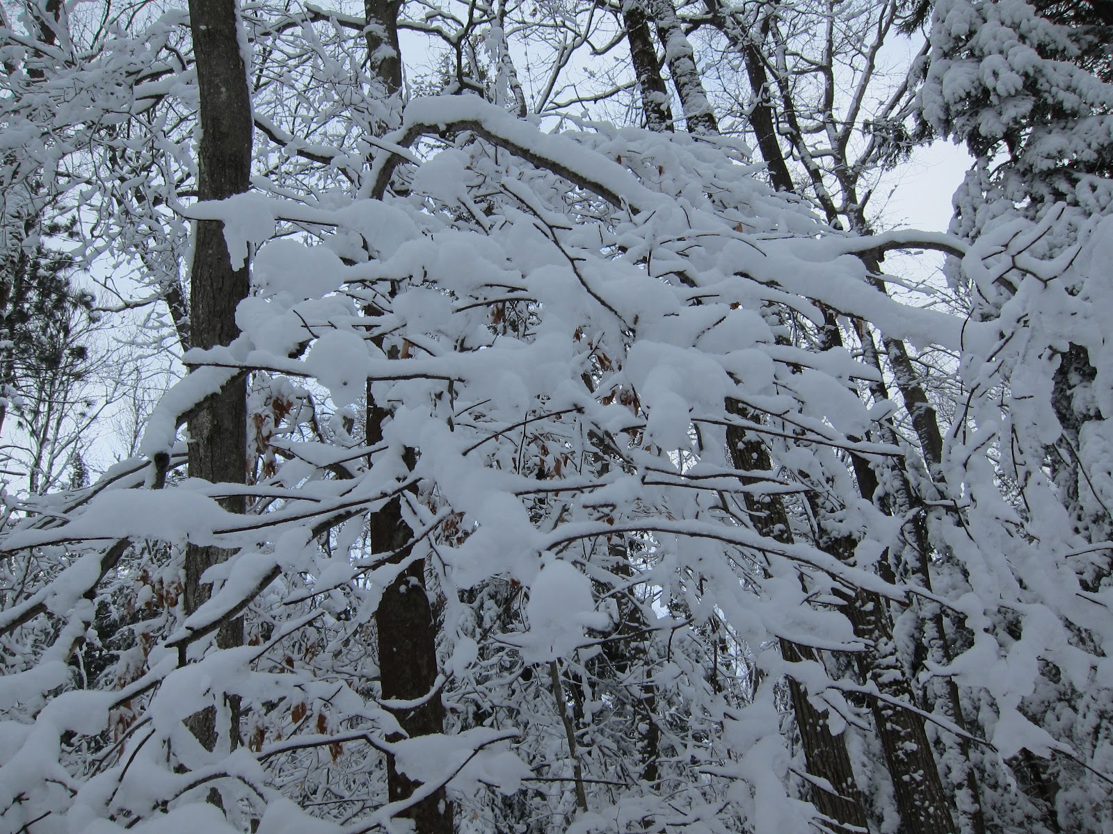
Site 505 - hope you're not looking for shade
On the positive side of things, I want to point out that the car camping sites in this park seem to be a bit of an anomaly for anything south of Sudbury.  They are roomy, well-treed and spaced appropriately apart (i.e. private).  As well, they're arranged in loops, not grids. I highly recommend this park for car camping, it seems to be well worth the drive. 


Site 505 - just two platforms


Saturday, March 10, 2012

Review: XC Skiing - Wasaga Beach Provincial Park

Ski Trails at Wasaga Beach Provincial Park
Location: Wasaga Beach, ON (45 mins NW of Barrie)
Website: Ontario Parks, Friends of Wasaga Beach
Map: Google
Camping Facilities: Car Camping
Grade: B+ (XC Skiing)
Thoughts: Just a short drive away from many population centres in Southern Ontario is the popular summer beach community of Wasaga Beach.  Reportedly a madhouse in the summer of people enjoying the white sand beach, the winter presents a different face.  The town becomes typical of a Southern Ontario waterfront community; sleepy, peaceful and with a generally slow pace of life.   The scene at the local provincial park was no different, with the primary activity being Nordic skiing (both track-set and skate).   It's an excellent beginner's park for XC skiing, with relatively inexpensive ski rentals, reasonably priced trail passes and a number of modest trails.

Snow at Wasaga Beach Provincial Park
While many of the trails we skied on were marked moderately difficult, we (as relatively novice skiers) didn't have any trouble.  There are a few ups and downs, enough to keep it exciting, but nothing too difficult that resulted in any severe wipe-outs.  The beginner trails were flat, and not very exciting (though the weather made up for it as there was plenty of fresh snow and temperatures hovered around freezing).  In addition, it wasn't even very busy, having not seen more than two other parties during our 3 hour stay in the park.  One word of advice is that you might want to consider coming in the afternoon to take advantage of the half day rates, as there probably isn't enough here to justify spending more time than that (and you'll probably be pretty tired if you're a beginner like we were).

This place was a great alternative to Hardwood Hills (which is not far away, but much more crowded).  Plus you can support the provincial park system, which is always a good thing.  My only caution is that it might not have much to offer more advanced skiiers.

Ski Trails at Wasaga Beach Provincial Park


Snow at Wasaga Beach Provincial Park 


Saturday, May 28, 2011

Review: Algonquin Interior - Kingscote Lake

Sunset on Kingscote (from NW site)
Location: 1 hr northwest of Bancroft
Website: Friends of Algonquin Ontario Parks
Map: Canoe Routes Map Google Maps
Camping Facilities: Backcountry exclusively
Grade: B
Stargazing: Excellent, watched Persieds from here.
Summary: Nice enough
Thoughts:  This was a one-nighter for me, just a quick get away to have a look at the Perseid meteor shower back in 2007.  It was an ideal meteor watching night, with no clouds in the sky, and barely any moon to drown out the night sky. The only real challenge was that my camping partner and I were driving each other nuts, arguing over camping practices and etiquette, nearly coming to blows at one point in the middle of the lake over how much talking is acceptable when canoeing at night. (I know, petty, but it seemed really contentious at the time!)

This is a part of Algonquin that is a bit of a mystery to me.  Even though it's at the southern-most tip of Algonquin park, nobody goes here because you'd have to rely on slower two-lane highways to get you to the park (the Highway 400 is of little use here).  Hence it takes a little longer and there are fewer access points (limiting the number of trip options).  But we were already in the Ottawa Valley, so it made for a reasonably good stop over with a reasonably dark sky.

NW-most site on Kingscote
The access point is a bit of a funny one, where you purchase your permit just south of the access road to the park (do that first, so you don't end up driving to the put-in only to find that there's no permitting office).  The permit office is actually within a trailer campground, so you can pick up a few last minute items as well (I recall there being maps, bait and snacks). Then you trek back up north (15-20 min drive) to the Kingscote put-in.  The lake itself is nothing to write home about (see the images), but it was relatively peaceful for us despite there being a few cottages on the lake.  We stayed at the northwestern most site, which is pretty isolated, and you don't really have a view of many other sites.  It's not one of the best sites we ever stayed at, and we definitely needed to paddle out into the middle of the lake to get a better look at the sky.  However, it's pretty spacious as you can see from the photo.
Kingscote Lake

I'd like to go back in sometime to explore the York River and the Scorch Lake hiking trail, to see if there is more of interest in the southern part of the park (it's not exactly well-kept either, with many of the lakes further up the "stem" of the park having low maintenance frequencies).

Anyways, if nothing else, you now can see a few images of the lake and the site on the northwestern bay (have a look at the map).  This part of the park doesn't have much in the way of scenery, nor seclusion on this lake, but might be worth investigating further into the park. 

Friday, May 27, 2011

Review: Little Clear Lake, Frontenac Provincial Park

View from site on Little Clear Lake
Location: 50 km North of Kingston, ON
Website: Ontario Parks or Friends of Frontenac
Map: Google Maps
Camping Facilities: Backcountry Exclusively
Grade: C
Stargazing: Not bad, you get light pollution from Kingston though.
Summary: Easy to access, great backcountry experience for novices, sites are too close together
Thoughts: This park is great for people new to the backcountry, it's pretty easy to access off Highway 401, and there are some pretty good hiking trails too. Heck, even the drive to this park is nice. But the bottom line is: the camping stinks.

If I were to tell you that the planners of this park thought it was a good idea to limit the number of sites on each lake to 4 (though Big Salmon, which is a large lake, has 10), you'd probably think that sounds pretty good. I thought it sounded pretty good. But once you see the map, you'll notice where this planning went awry; all the sites are clustered together in groups of 4, no more than 10-20m apart. So essentially, its a little bit of car camping magic in the backcountry, except with none of the luxury and all of the work. So if you camp on a full lake, you better be in a sociable mood.frontenac provincial park camping ontario

I'm not sure of the reasoning behind placing all the sites in clusters. Maybe they wanted to contain the environmental degradation that is associated with setting up camp to smaller pockets. Maybe they thought it facilitates social interaction (maybe that sounds attractive to you and I'm just being a presumptuous jerk about it). But clustering the sites just seems like a waste, given the limited backcountry camping opportunities that exist within a reasonable drive of Southern Ontario's urban areas.

Hiking: I recommend the Doe Lake hiking trail for a few reasons: its got a nice lookout which the park staff have lugged a bench up to, there are some beaver ponds along the way, and you spend a good amount of time walking by the water on the first half of the hike, as well. My only suggestion is that you double back after you reach the look-out bench; the second half of the hike just meanders through forest with nothing interesting to see, so you will be bored (unless you're a tree biologist).

From the park map, I can see that the sites on Buck Lake are just barely contained within the park, with the rest of the bay being private property.  I'll take that to mean that they'll be sharing their wilderness experience with cottagers with power boats.  So it seems the southern part of the park is completely shot.  I'd be very interested to hear people's comments on the more northern parts of the park, do they salvage the lame camping set-up?

Some notes from my limited experience with the park (limited because its just not worth repeat visits):

-Big Salmon Lake: can get chopping due to its size and orientation, but a nice paddle
-Little Clear Lake: The portage in from Big Salmon is a bit hilly and rocky (hence dangerous when wet), but bearable in length. The sites here can be breezy which is good for bugs, and are generally well shaded. See above for an image from a site on Little Clear Lake.


Portage Descriptions (from Park Tabloid, 2011)