Showing posts with label National Parks. Show all posts

Sunday, June 17, 2018

Review: Cashel Campsite, Loch Lomond and the Trosachs National Park

Loch Lomond from Ben Lomond
Location: An hour from Glasgow
Website: "Camping in the Forest" website - Cashel Campsite
Map: Google map
Camping Facilities: Car camping
Grade: C+
Stargazing: Very good
Summary: No caravan? Sleep in the ditch.
Thoughts:  Before I get into my review of the campground, I need to talk about midges. This was the first place I ever camped in Scotland, having wanting to see Loch Lomond ever since I first heard John McDermott crooning about her bonny shores when I was wee. But the Irish Tenor never paid sufficient tribute to the Highland midges. To be honest, I had been warned of midges, but didn't think much of them because, you see, I'm from Canada and we have mosquitoes the size of ravens, stalking around our campgrounds, and dreaded black flies that carelessly tear your flesh as they finish feasting on your delicious circulatory fluid. Clearly nothing can compare to these. I mean, really, how bad can a tiny flying flea really be? Listen Canadians, they're bad. They're really bad. They're actually horrifyingly bad. They're relentless, they don't fear the sunlight and they strike in swarms when you're tired & sweaty and simply trying to reap the rewards of your arduous hike! We got halfway up Ben Lomond on a beautiful late summer (mid-Sept) day and were stunned. Just as I was snapping a few photos, they descended with their fury, a dozen tiny, itchy pin-pricks all at once, never pausing for a moment's mercy. Then they'll itch for a good day or so. So be warned - bring some DEET or bring some meshy hats. Cover your skin as much as you can bear. Otherwise, take shelter.

You can camp on the verge if you don't have a caravan
Okay, enough about midges, on to the review of Cashel campsite. First, it's very conveniently located, just off the main road to Ben Lomond. I noticed a lot of people complain about the quality of the road leading up to it, but truth be told, I don't recall it being that bad. We pulled up and tried to track down the person responsible - the office closes a bit earlier than I'm accustomed to, and I believe we caught them right at the end of their shift (I think it was around 5ish). I was a bit taken aback when we were told where to camp at Cashel campsite. "You can set up anywhere on the grass there". "There" being the grassy median between the roads in the campground. Adjacent to the toilets and wash-up area. Convenient, yes. Pleasant? No. I definitely felt like a second-class citizen (resident?). Yes, it's true, we didn't have a camper van or a caravan or whatever you want to call it. But we're still human beings.  I mean, the campground itself couldn't be more beautifully situated along Loch Lomond. But if you don't have a vehicles that gets 2 miles per gallon, you cannot by any means sleep next to the Loch? It's a bit odd. I would have thought we would be rewarded for having versatile accommodations that can be plopped down anywhere we can squeeze. But the nice sites are for the folks who camp with kitchens and duvets, I'm afraid.

A handy map of the Ben Lomond hike
Look, I get it. A lot of the sites are rented seasonally by folks who own these homes-away-from-home. I know the site is not intended to preserve the natural environment or encourage low-impact camping. It's a business, with a first-come, first-served attitude for access to the prime waterfront campsites. But a tiny patch can't be reserved for the tourist who might be passing by, looking for a place to stay next to the beautiful lake nestled amongst the mountains?

I guess I'm just disappointed with it all. But it doesn't mean you can't find a nice spot to snap a few photos of the sun setting behind the mountains, casting a few golden rays on the lake (see below). You just can't fall asleep while doing.

Some final comments. The campground itself is in very good condition, where the toilets are spotless, the washing-up area is tidy and useful. Again, I noticed on the reviews on their website that a number of people thought the toilets were shocking. It may just be a matter of differing standards, but I thought they were quite good overall. Plus the setting is absolutely gorgeous - this on its own is a good reason to stay. The hiking close by is also excellent, with many beautiful views available (see the map provided here for some inspiration for Loch Lomond). My only major complaint is that better accommodations should be provided for campers who sleep on the ground, rather than on beds.


"The steep, steep sides of Ben Lomond"
Sunset over Loch Lomond


Friday, February 12, 2016

Review: Hattie Cove Campground, Pukaskwa National Park

Playter Harbour, Coastal Hiking Trail
Location: Hattie Cove Campground, Pukaskwa National Park
Website: Parks Canada
Map: Parks Canada
Camping Facilities: Car Camping
Grade: B
Stargazing: Good by the Lake
Summary:Average camping enhanced by being close to glorious Lake Superior and pristine forest setting
Thoughts: The plan was to make my way along the Trans Canada highway towards Thunder Bay, aiming to meet up with some friends along the drive for some camping. I originally had Slate Islands Provincial Park in mind, after reading this article about it's dense elk population (imagine having elk roaming through your site). I was stoked, but then I found out it would cost $500 for a return shuttle from Terrance Bay. Split between 6 couples for one week, you could make a strong case for it. But with just 3 people staying only one night, it would be a total waste. So my friends suggested Pukaskwa (pronounced Puck-a-Saw, as I quickly found out). I had been meaning to see it for quite some time, and figured that it's a low-stress option to enjoy the company of old friends whom I hadn't seen in a while.

Lookout over Halfway Lake
The camping itself was just okay. Some sites are a little more private than others; you'll find that some are inexplicably directly across from one another, with only your cars to provide the necessary screen to avoid any awkward eye contact. But a few sites are large and pretty private. I wanted to see 48, which is a bit off the road and sits next to Halfway Lake, but it was occupied and I was told it's a bit buggy (you can see in the photo on the right that Halfway Lake is a bit swampy). Site 46 would be a winner if it weren't clearly visible from the path to the comfort station. Speaking of which, the comfort stations in the park are clean and comfortable. And as with all National Parks, you pay twice - the entrance "day-use" fee and the camping fee - which I find a bit irritating, but it still ends up being cheaper than car camping in Ontario Parks (by about $3 - 2015 fees). The park staff I dealt with were really thoughtful and allow you to take a drive around to see what site you like best, then register after you've had a gander. You're likely to find something good, but yea, nothing special.

Middle Beach, with it's piles of driftwood
But putting the camping aside, the setting of the park itself is phenomenal. Just a short 5 minute walk from the campground, you're on Lake Superior, with its thunderous waves drowning out any thoughts of the real world that might have followed you on your trip. You could stare at the Lake for hours, watching it play Hot Potato with the beach, as the waves toss the driftwood to the beach and the beach rolls it right back. And at night you'll find that the Middle and North Beaches (probably Horseshoe Beach too) are spectacular for stargazing. The day hikes to Manito Mikana, Horseshoe Beach, and the Southern Headland Trail are all well worth the trip and you'll be entranced by the vistas. I thought the lookout over Halfway Lake (above) was worthwhile (just after you start a counterclockwise tour from the trailhead), but the rest of the hike looked a bit boring so I skipped it. Please correct me if I'm wrong.

Boardwalk at the beginning of the
Pukaskwa Coastal Hiking Trail
The highlight of the park is the Coastal Hiking Trail. With its many campsites and nearly pristine Lake Superior coastal scenery, it is a worthy adventure. There is justification for the use the word "pristine", as you can see from this map that Pukaskwa is one of the last remaining intact forest landscapes in the southern half of the province, as discovered by the IFL mapping team. I was only able to hike to the first campsite, but even that one (Playter Harbour) was something to behold (top of the page here). The backcountry site itself was really spacious, with an outhouse, fire pit and food locker. I'm curious about the other sites, as they contain up to six individual sites - are these clustered together? Or are they somewhat private? Please comment below if you know. As well, I should point out that the trail is well marked and easy to follow, but would be very slippery in spots after a bit of rain.

Lookout from Southern Headland Trail
I'd love to come back and at least make it to the White River Suspension bridge, but it's a full day hike (leave before 10am). A fellow hiker informed me that he wanted to do a one-way hike and get a shuttle back from the North Swallow river, but the guiding company was going to charge him $500 for the trip back so he just walked the whole stretch in a return trip (solo no less!). What is it with $500 shuttling fees in this part of the province? Regardless, Pukaskwa is worth your effort because it's just a beautiful spot - the camping is a means to discover the splendor of this unique wilderness refuge.

Food locker on the
Coastal Hiking Trail
Outhouse on the Coastal Hiking Trail


.


Sunday, January 17, 2016

Review: Car Camping, North Lees Campsite, Peak District National Park, United Kingdom

Peak District from Stanage Edge
Location: 30 mins from Sheffield (10 miles)
Website:  National Park or Campsite
Map: Google Maps
Camping Facilities: Car camping
Grade: C
Stargazing: Good
Summary: Acceptable camping experience in the UK (my first)
Thoughts: After entering the park with little fanfare (the color of the terrain on my GPS changed from beige to green, if I'm not mistaken), I knew that I had to keep my expectations in check.  No park office, no visible change in land use, sheep eyeing you suspiciously -  clearly things are done differently here. As we zigged and zagged along the country roads, we had hopes that the vast wilderness that is the Peak District National Park would eventually reveal itself around the next bend. It does, but not in the way that we're used to. But that's okay. The UK is a small country with a relatively large population (compared to Canada), so one can only expect a certain level of solitude and remoteness. And maybe within the campground itself things would be different. Well it was, and it wasn't.

Sheep and grazing fields
- mainstays of UK National Parks
The flocks of sheep that greet you on the roadsides within the National Park were not welcome in the North Lees Campsite. No sir, gates and fences made their access impossible. A win for conservation! The camping experience, however, was consistently frustrating as the rest of the drive to that point. First off, the site was sloped, and quite dramatically so.  Good luck finding a level spot to sleep comfortably. Second, there is no demarcation of campsites. It's a total free-for-all. Where ever you'd like to stop walking/carrying gear, well, that's as good as any spot, friend. Thirdly, no demarcation of sites also means no privacy.  None. Nor are there many picnic benches to cook your breakfast (most people seemed to be happy to do so on the ground but we grabbed one of the few that there were).  Last, there are no campfires. Given that there are so few trees in the region to begin with, it's probably for the best. But yeah: "sigh".

Nice spot to wash dishes
Bears aren't an issue...
Sheep - you are fenced OUT!
Some good points that I need to bring up. The place is very tidy. You have nice shower facilities as well as running water for washing dishes (a bit of a hike from some of the "sites", so bring a container of some sort, like a bucket or camping sink). You also have recycling facilities and very kinds, friendly staff running the place.  And the connectivity to the splendid hiking trails within steps of the campground is excellent. Another bonus - you can walk to the pubs in Hathersage in about half an hour. In doing so, you'll stroll through quaint English countryside and maybe learn to appreciate it on its own merits, and not in relation to those of a totally different country that has no physical resemblance to the one you're living in, so you might as well stop whinging about it.
A second camping space that is a bit flatter

As a Canadian out on their first camping trip in the UK, I could have done worse than North Lees. Once you have acclimatized to the setting and your eyes have adjusted to the local scenery, you'll probably find that it does what it does pretty well. It's just different, that's all.

Interpretive sign maintenance varies...
Weather may vary as well
View from Stanage Edge


Peak District National Park
Mam Tor


Mam Tor was a gusty spot that day
Some trails veer onto private land,
but the signage will get you back
on track
Roadway carved right into
a drainage channel


Sunday, May 25, 2014

Research: Camping in the Thousand Islands National Park

A bit of a departure from my usual format - I've been doing some research on camping in the 1000 Islands National Park and thought that I would share some of this consolidated information for people who are interested.  The park is an unusual camping experience, where you'd be camping alongside an important waterway of both touristic and commercial value, so you may share the water with cargo ships, speedboats, yachts, sailboats, motorboats, kayaks, and/or canoes.  This is enough to turn off a lot of the backcountry camping set, and with good reason.  But if this doesn't deter the intrepid, adventurous spirit that compels you to explore every last patch of nationally or provincially controlled parkland, then I've created list of pointers from various sources to help get you on your way.  Personally, with all the logistical issues, I'm hesitant to head out to these campgrounds. However, it certainly is a unique camping opportunity in Eastern Ontario, which is sorely lacking in quality camping opportunities (though this one may not qualify). 

Things to consider
  • There are 20 islands of varying distance from the mainland available for camping, dispersed along an approximately 75 km linear stretch of water.  This means that some islands will be very far from mainland pubic docking points, while others might be more conveniently located - consult the following services chart from Parks Canada and Google Maps.  Some docks require payment, some do not (likely watercraft dependent). 
  • There are no water taps at any of the island campgrounds.  This means you'll either want to lug in bottled water or filter from the river. Most sites I've seen are written by folks who are put off by this, as am I; as great as my water filter is, I'm not confident in its ability to remove the potentially wide array of contaminants flowing in from neighbouring municipal wastewater treatment plants, boat traffic, cottages and industrial effluent.  This is likely an overly cautious position to be taking, as the concentrations are likely low and dosages are small, but the uncertainty here is also high - hence I'd choose to avoid it (has anybody seen any testing on St. Lawrence water quality in the area?)
  • The islands typically have multiple docks, with many campsites scattered along their hiking trails.  Some of these require payment, some are free, some are designated for paddlers. Hiking into your site on an island hiking trail sounds great until you consider you're likely lugging in your water.  Fortunately, it seems most sites are located within a few hundred metres of the docks. As well, be warned that many of these sites are clustered together - e.g. Camelot Island, Beau Rivage
  • You're on a busy seaway - you will not find solitude, peace & quiet, nor dark, starry night skies here.  In addition, many islands have mooring buoys just offshore, so the potential for noisy neighbours exists both on land and on the water
  • A few campers have recommended certain islands:
    • From Trip Advisor (lecdm) - Camelot, Aubrey
    • From CCR (Kim Gass) - Endymion, Camelot and Gordon and Mulcaster

Valuable Resources
  • Parks Canada - It's in dire need of a redesign since this website feels very "early 2000s", but we must appreciate that Parks Canada gets shamefully little funding. If you do enough digging, you'll find a lot of valuable information here. Most notable are the pages with the maps for the individual islands and the chart of the facilities and services.
  • Frontenac Arch Biosphere - Trail information, maps, outfitters, route info, etc., just a fantastic resource for this area and the rest of the Frontenac Arch Biosphere
  • My Canadian Canoe Routes - The forum should be browsed for the latest information, though in truth this park doesn't get much discussion.

Monday, February 17, 2014

Review: Snaring River Overflow, Jasper National Park

Location: 4 hrs from Edmonton or 15 minutes from Jasper
Website:  None
Map: Google
Camping Facilities: Car Camping
Grade: D+
Stargazing: Okay, but some interference from Jasper
Summary: Free-for-all car camping madness, with no campfires allowed - but in a nice mountain setting
Thoughts: Planning to go to the campgrounds immediately surrounding the Town of Jasper on a long weekend without a reservation?  Well, this is probably one of your few options.  Most of the other campgrounds will be full, friend.  That's what we discovered when opting to head up to the Jasper townsite instead of the tried-and-true Columbia Icefield Campground along the Icefields Parkway (which did have vacancies).  What we discovered was beyond comprehension for an Ontarian used to the calm and order found in the Ontario Park system. 

If you're early to arrive, find a decently-sheltered patch of dirt near(ish) to a latrine and set up.  If there's a picnic table, bonus.  If there is a flat surface to set your tent up on, double bonus.  Chances are high that if you're late to arrive, you'll find none of these.  We discovered people just setting up anywhere that looked reasonable.  There are no comfort stations, just latrines; neither are there any fires allowed (though many plumes of smoke were observed rising over the campground...no enforcement was evident).  The campground has little else to offer.  There are some scenic views of the surrounding mountains, but this isn't where you want to view them from.

We can at least appreciate Jasper Park's management and staff trying to accommodate anybody who is foolish, er, spontaneous enough to come up here without a reservation on a long weekend.  But there's no certainty that you'll get anything that approaches a decent site.  In fact, the night we were there, you'd have been lucky if you didn't end up sleeping on a uneven gravel-laden mound of dirt without a twig of privacy.  Plan ahead, stay out of the overflow.


Thursday, March 28, 2013

Review: Illecillewaet Campgroud, Glacier National Park

Illecillewaet's rushing
mountain stream
Location: 1 hour east of Revelstoke
Website:  Parks Canada
Map: Parks Canada or Google Maps
Camping Facilities: Strictly car camping
Grade: A-
Stargazing: Tough to find a good clearing, with all the trees and mountains, but they're nice to look at as well.
Summary: Good privacy, beautiful scenery, excellent park resources
Thoughts: There's a bit of an abrupt transition that hits you on the drive between Banff National Park and Glacier National Park.  Sure, you enter a different mountain range but that's not it.  Very suddenly the crowds diminish, the traffic subsides and you find your self in a beautiful place that is completely devoid of kitsch.  There's a genuine feel about the natural environment captured by the boundaries within Glacier that seems to be missing the Epcot-centre feel that you get from roaming the streets of the town of Banff or the tacky tourist shops that find in Jasper.  Sure, there's a visitors centre in Glacier, fully stocked with fridge magnets, t-shirts and knick-knacks.  But its really just a minor part of the visitors centre which functions mostly as an interpretive museum for you to learn as much (or as little) about the patch of our planet protected by the park's boundaries.

Wood shed with wheel barrow and barrow-bike
Due to it's distance from large metropolitan centres, you don't get any daytrippers in Glacier.  You strictly find the folks who are trying to explore this region of Canada, most of them by car, but also plenty of them on foot in the backcountry of this rugged wilderness.  Alpine huts and backcountry campsites are dispersed amongst the mountain scenery.  Ah what a splendid thing it would be to sleep atop the Selkirk mountains, but given the late season and the size of our party (2), we opted to remain on the beautiful Illecillewaet campground instead.  Illecillewaet is nestled next to a mountain stream just before the Trans Canada highway veers west, just south of the Roger's Pass Discovery Centre (visitor's centre).  (It's a treacherous turn; one night, I awoke to what sounded like garbage truck emptying a dumpster.  In fact, it was the sound a transport truck jack-knifing and flipping over while taking the sharp turn at too high of a speed.  I realized this upon our departure the next day, when I saw cab and its eviscerated trailer laying across the highway, with it's contents spilled all over the scene.)
Food storage lockers

This campground has a pleasant, uncrowded lay-out, with loops instead of a grid.  There are plenty of trees that act as physical barriers between sites, further increasing seclusion.  As well, the sound of the mountain stream drowns out much of the noise you might otherwise hear from other occupants, adding that much more privacy to your stay.   The services provided within the park are on par with the best you'll find in the national parks; warming huts, a few nicely maintained washrooms (no hot water, no showers), lockable food storage bins, and a very nice wood shed, equipped with a wheel-barrow-bicycle so that you can transport your load of wood with great ease.  All in all, about the best your can hope for in car camping site - maximum privacy that can be afforded (it's still a popular national park after all), great amenities, and adjacent to close to some very nice hiking trails.

Warming hut
In sum, Illecillewaet is a winner in the National Park system.  A nice balance between comfort and privacy, situated in a genuine wilderness zone in one of the most scenic parts of the country.


Atop the Meadows in the Sky Parkway,
a close drive from Glacier


Tuesday, August 9, 2011

Review: Chilkoot Campground, Sierra National Forest (Yosemite National Park)

Location: 4 hrs from San Francisco
Website: USDA Forest Service
Map: Google Maps
Camping Facilities: Car Camping
Grade: B- (Chilkoot)
Stargazing: Heavy canopy, so not great
Summary: Limited services, friendly staff, painful drive into Yosemite
The crowds in the valley
can get dense
Thoughts: If you want to camp in Yosemite National Park during peak season, book early.  As early as possible.  Otherwise, you won't be camping in Yosemite National Park.  That was the lesson I learned when trying to book two weeks in advance to stay in this beautiful park.  No, as the title above suggests, two weeks was not early enough.  So instead I stayed at the closest available public campground, in Sierra National Forest.  If you want to explore Sierra National Forest, I imagine this campground is quite convenient.  If you want to explore Yosemite, it is not.  You'll have to drive roughly 30-45 mins before you even enter the park.  Once you arrive at the park, depending on where you want to go, the drive can get much longer. You're at the Mariposa Grove of Sequoias when entering here, but getting to the valley is likely another hour (depending on how slow the car you will get inevitably get trapped behind is going) and so is Glacier Point.

On-site water source
at Chilkoot
The Chilkoot campground, other than being a little tricky to find since the directions that you receive upon booking tell you it's on Beashore Rd, though GPS data and Google Maps call this Beasore Rd.  But once you've figured that out and make it to the campground, you're fine.  It's then just a matter of settling into the site and getting a visit from the campground host who will register you.  This was a very pleasant experience with our host, who was friendly and helpful (we were able to purchase firewood for $7 a bundle, two of which lasted the 3 night stay).  The main inconvenience is getting water; we lugged water up the steep, unmarked path from the creek (which you can find mainly because its audible from all sites).  Our host kindly offered to supply us with some water (though I'm not sure what the cost would have been, or if there even was a charge), but other than that, you'll have to get your water in the nearby hamlet of Bass Lake (which also sells gas cheaper than you'll find in the park, or even just outside of the park on the highway 120).

Sites are in close proximity,
but not uncomfortably dense
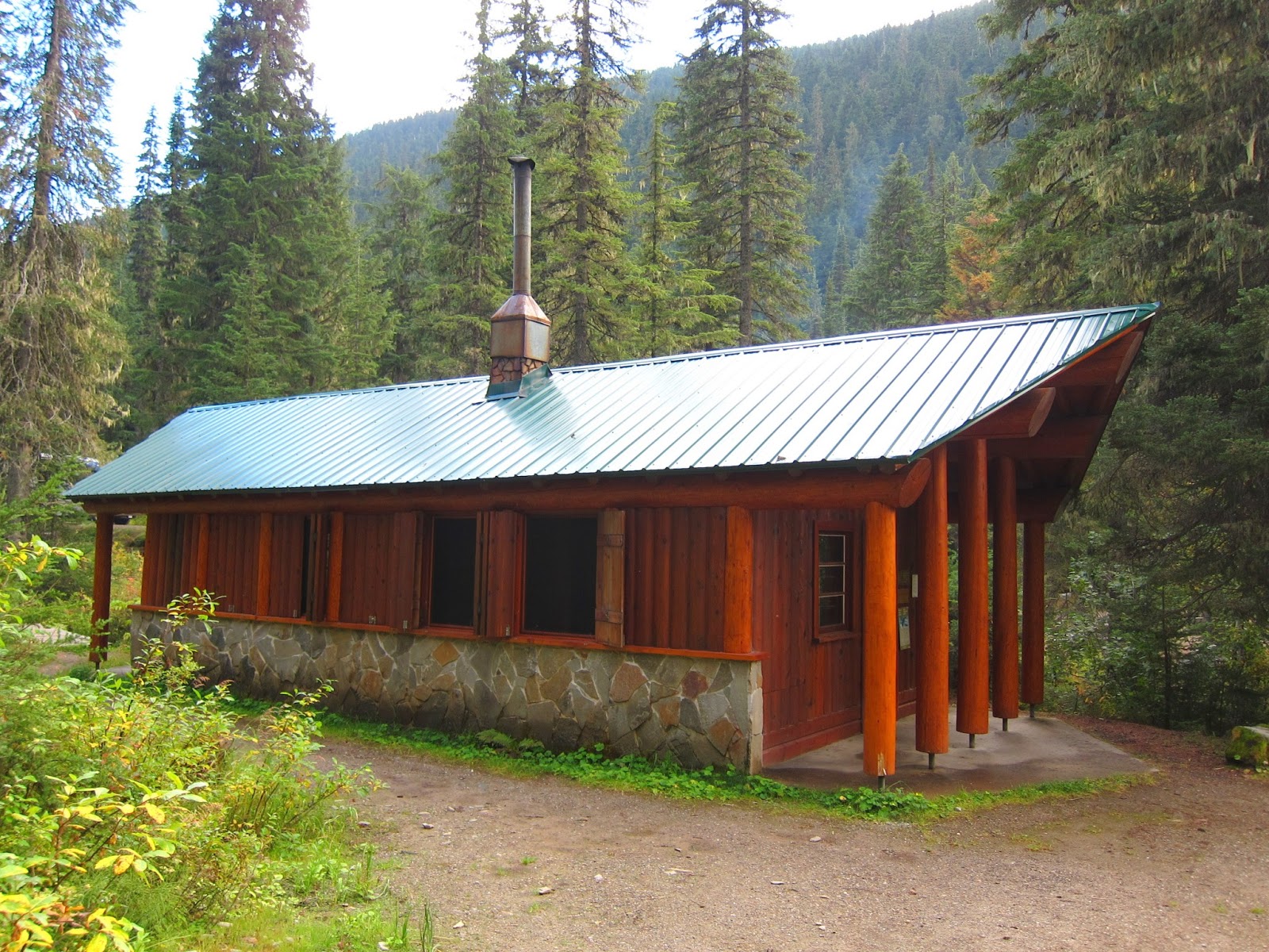
The sites themselves are better than average for car camping, even with the limited services.  There is a reasonable amount of privacy, considering it is car camping.   The privacy stems from there being only 14 sites in the campground, making a single loop around a few outhouses.  The sites themselves are very large, and since it's a single loop, you aren't completely surrounded by sites, just adjacent to and/or across from them.  However, the sites are wide open, as you can see from the picture.  Additionally, there is no scenery to speak of at the campground, just trees and the creek (which isn't visible from the sites, but is audible).

Yosemite

Wildlife in the Mariposa Grove
Yosemite is a spectacular spot.  The natural beauty of the park is breathtaking, though the crowds and staff in the valley detract from the experience.  The valley was extremely busy when we went (mid-June), and, while beautiful, it has an amusement park feel due to the hoards of tourists.  Try to allot a single day to visit the valley; that way you can see its many great views in one shot (it's easy to drive from one to the next), then you don't have to make the trip back down.  Regarding the staff in the valley, most that we encountered were somewhat ignorant of the park.  Often they wouldn't have answers to questions on the locations of trails or where to get a park map or if the park store had wifi (it does, and you don't need to pay), and there are large line-ups to access staff that seem better informed.  Many of the staff were volunteers, possibly seasonal, perhaps in their first season at the park.

View from Wawona Point
If you want to escape the crowds, all that needs to be done is to travel a little further up the trail head.  After you're about 500 meters (1/3 of a mile for my American friends) down most trails, you'll lose most of the more laid-back park visitors; most seem to have the few main attractions to check off their lists (Grizzly Giant in the Mariposa Grove, Yosemite Falls, Bridalveil Falls, Glacier Point, maybe Sentinel Dome) and don't make it much further.  But fortunately there is much more to see.  A great hiking resource can be found on this site, so that you can plan accordingly.  Some spots where we found very few other hikers on the trail, but that were very nice include:
  • Upper Mariposa Grove (much nicer and more densely populated with giant sequoias than the lower grove), and Wawona Point (provides a spectacular view that you'll have all to yourself)
  • Taft Point (though it was covered with snow so we didn't make it very far)
  • Artist Point
View of the Valley from Glacier Point
Many fallen trees on
the way to Artist Point
The biggest issue with hiking in Yosemite is the grossly insufficient trail marking.  There are very few trail blazes, in fact some trails didn't have a blaze to speak of, just signs pointing the way at the trailhead.  If a trails isn't well trampled, it would be easy to get lost...just as we did on the Taft point trail (the trail was buried in snow).  In addition, less popular trails are very poorly maintained, with fallen trees and limbs blocking the path (see the photo of the trail to Artist Point on the right).  Considering the number of inexperienced staff, poor maintenance and terribly marked trails, I suspect the culprit here is under-funding.  While this might be expected in less popular parks during these turbulent financial times, to find that this is the case in the 3rd most visited park in the US was a shock and a great disappointment.
Museum at Upper Mariposa Grove

View from Artist Point - worth the trek