Thursday, August 22, 2019

Analysis of Ontario Parks Statistics 2004-2017

2019 Update on Ontario Parks Statistics

Greetings fellow campers,

It's been a while since I last reviewed the state of camping in Ontario through their annual parks statistics report - nearly 4 years actually. A lot has happened in that time - Canada turned 150 years old, gas prices dropped and rose again, the Canadian dollar has dropped substantially in value relative to the US dollar, and Ontario recently elected a new goverment. While it's too soon to analyse the data on the last point, we can look at the implications of the other two.

Last time I had a look, the number of park visitors had been in decline for a decade, dropping from 10.5 million visitors in 2005 to 8.5 million in 2014, a stunning 19% decline in the number of visitors at a time when Ontario's population had risen by 11% (2006-2016). Looking at the latest data, this trend has reversed somewhat, which is good news. In fact, park visitation reached recent highs over this period, topping out at over 10.5 million once again in 2016 (I should reiterate though, this is drawing from a larger population, so if the number of out-of-province visitors has stayed constant, the proportion of people who are camping is still in decline).

As I mentioned, gas prices and the Canadian dollar have declined in that period (though gas prices have seen an increase lately), making visits from American tourists potentially more attractive in recent years. The data available in the 2014 report suggested this may have been a factor with the share of US visitors dropping from 11% to 6% between 2006 and 2011 (the only two years where data were available). Looking at the figure above, there does seem to be some sort of inverse relationship here, with annual visitors seeming to dip/stagnate when gas prices rise (to some degree), but the drop in gas prices in 2009 did not provide a bump in visitors. As well, I ran a regression analysis with visitors and gas prices (I know, a very limited data set) and for what it's worth neither seem to be statistically significant for the park system as a whole.

The number of camping nights per camper had also dropped in 2014, by around 10-15%, from around 3.7-3.8 to 3.3. So it seemed that campers are staying for shorter amounts of time. Unfortunately, this trend has not reversed much, with the average stay per camper still hovering at around 3.2 in 2017, down from the recent high of 3.8 in 2006.

A number of factors could be at play here, including increased nightly camping fees over that time period. For example, regular "premium" camping fees for an electrical site wish showers was $33/night in 2005, incl GST. In 2017, it was $51.13/night, incl HST. If you adjust the $33 for inflation, it would have been $40.18 in 2017 - so that would give us roughly a 25% increase in nightly fees. I should also point out that GST was only 7%, while HST is 13%. It's not much better in the backcountry; in 2005, Bon Echo and Algonquin were $7.50 and $9, respectively - $10.17 and $12.43, in 2017; these represent increases under 15% after adjusting for inflation, but it's worth noting that these are per person fees. In Algonquin, you can have up to 9 people on a site, so that would be a nightly fee of $112 for a fully-occupied backcountry site in the province's more popular interior camping park!

I should state that this average length calculation I've made may be flawed; when looking at the definitions provided in the park statistics, we can see that "average length" and "campers" data seem to contain a circular reference to one another; determining which is derived from the other isn't clear from their glossary (at least, I think we can say for certain that "camper nights" is taken from Ontario Parks gate data and I would guess that "campers" is too). I would expect this to be independent of factors such as gas prices or the CAD, and would have expected that that those campers who make the time and effort to visit a park would want to stay longer due to all that congestion and those high gas prices.

The number of campers per visitor, which might indicate levels of interest in camping, have stayed pretty steady - a very slight dip in the years between 2005-2012, but recovering back to 2004 levels by 2017. This suggests that overall interest in camping is stable, and day visitors are continuing to do what they do, with no new motivation to stay the night.

A topic that I didn't touch upon during my previous analysis was the backcountry, which is odd, because I love the backcountry. Personally, I have hope that if Ontario Parks see increasing interest in backcountry camping, they'll increase the total number of sites available by preserving and developing more crown land for this purpose. So I've decided to dig into the data this time to see how visitation has changed in this period. Ontario Parks doesn't do regional summary statistics in the annual parks stats report (which can be obtained if you ask very nicely to the folks at the MNRF), so all of the data needed to be entered manually into a spreadsheet. I only have the reports from 2010-2017 available, but hopefully that provides an interesting picture nonetheless.

I think that the results are indeed interesting. Looking at the overall picture, you can see that there has been an impressive increase in interior camping nights. If you simply compare 2017 to 2010, some shocking figures result; 25% increase province wide, 34% increase in NE Ontario, and a shocking 200% increase in SE Ontario. However, the numbers vary year-to-year; I would guess this has something to do with weather, perhaps particularly around long weekends, but this is just a guess without more detailed data. If you just take the 3 year averages around 2010-12 and 2015-17, you get more plausible sounding increases of 15% province wide, 9% increase in Algonquin, 80% increase in SE, and 22% in the NE. The only alarming figure is a 4% drop in backcountry camper nights in the NW. However, since there are just so many opportunities up there for crown land camping (free!), it could just be that any increases in interior camping are occurring outside of the parks system.

The overall changes in interior camping activity could mean that people are staying longer, more people are staying in the backcountry, or both. Ontario Parks doesn't publish data on the number of interior campers per park or per region (just camper nights), so we can't say for sure. But what we can say for sure is that this is more revenue for Ontario Parks from interior camping. Of course, over 50% of all these camper nights (270,000 in 2017) are spent in Algonquin park. Just for a point of reference, there are 1900 interior sites in Algonquin - "only" 25% of all the interior sites in operating parks. So yes, it can be said that Algonquin received a disproportionate share of the Parks system's backcountry revenue. But given its location within a 3 hour drive of the bulk of the province's 13 million people, this makes sense, especially if you think all rocks/trees/lakes look the same.

A few other points - while Algonquin is certainly an interior camping behemoth, there has only been a 9% increase in camper nights (on the order of population growth in that time). The NE, on the other hand, has seen a 22% increase, while SE Ontario has seen a 80% increase in interior camper nights. This SE growth is a phenomenal increase, even once you take into account that half of this increase is attributable to the switch of Kawartha Highlands from non-operating (free to use) park to operating park. I take this to be a positive story about increased interest in backcountry camping that can be reached within a day's drive and I hope that we can find more crown sites that can be developed for Provincial Parks.

I could go on with more analysis but I'll stop there. I'd love to hear from you if you'd like to see more analysis, fellow camping quants. I could do some analysis on individual parks, engagement with activities...anything you might be interested in, just ask and I'll see if I can tinker with the data. I might even do it if I don't hear from you, I'm that much of a camping nerd. Enjoy the rest of the summer!


Sunday, August 18, 2019

Review: Sango Sands, Durness

View overlooking sandy cove at Sango Sands Oasis
Location: Durness, 5 hours north of Glasgow or Aberdeen, 6 hours north of Edinburgh,
Website: Sango Sands Oasis
Map: Google
Camping Facilities: Car camping
Grade: B
Stargazing: Overcast on our visit but probably quite good
Summary: Nice option to camp along Scotland's northwest coast
Thoughts: Seven days isn't a lot of time to see a big city, let alone an entire region/nation the size of Scotland. With it's varied scenery and abundant hiking opportunities, there's a lot that one can do to experience the "natural" environment (gotta use the quotes folks, the UK as a whole is on the extreme development end of rural area modification spectrum). But when you're doing a circuit of the nation, trying to get a flavour for the coasts, the lochs and the mountains, and factor in the travel time (lengthened due to the many single-track roads in the northern regions of Scotland) and you're lucky if you can solid day hike in. Camping then becomes a huge part of getting the full out-of-doors experience when you're cooped up in a car for so much of your journey.

Sloping but relatively spacious campground
We had planned to make Durness part of our trip from the very outset, given it's seeming remoteness at the far NW corner of Great Britain. Surely it must be unlike anything we'd experienced to that point, we thought. And we were right, the trip up there was spectacular, with many beautiful coastal bays and mountains to drive past. And we were also lucky to find a nice campsite in Durness where we could take in the sea air while we slept, at the Sango Sands Oasis campground.

Path to the edge of the bluff overlooking the Atlantic


The campground was relatively spacious, nestled amongst inspiring coastal scenery. The is a nice short hiking path with a boarded path that takes right to the edge of the bluff overlooking the North Atlantic Ocean. It's a mesmerising sight to take in, even on the cloudiest of days.


A very handy sheltered dining area
The amenities were good, with tables provided for sit-down, leisurely dining in the cooking shelter. It sure beats having to battle the wind and rain while you try to shovel your breakfast down before it loses all remnant warmth. The layout of the campsite was haphazard (per usual for UK car camping), setting up where ever you could find a suitable spot. The area we were able to find was sloped, so it didn't make for the most comfortable sleep, but you pitch your tent right next to your car, so that affords a certain convenience.


Delicious haggis at Smoo Cave Hotel
There is also excellent food available in town, with the Smoo Cave Hotel serving some of the (purported) best haggis in the area. In fact, it isn't made in Durness, sourced from a specialist butcher a few towns away. This was my first time tasting haggis, so I can't comment on its ranking, but it was delicious; a buttery flavour that reminded me of black pudding. When I mentioned this to the barman, he glared back at me with what I guessed was a mixture of irritation reserved for tourists and pity that I didn't know what I was talking about.

Panorama of the Durness coast


Saturday, August 17, 2019

Review: Lazy Duck hostel, campsites and eco-huts, Nethy Bridge

A campsite adjacent to a fire pit (with log bench)
Location: 30 mins NE of Aviemore, 3 hours N of Edinburgh
Website: Lazy Duck Hostel
Map: Google
Camping Facilities: Car camping, space for 4 tents
Grade: B+
Stargazing: Good, but not much open space to view...
Summary: Good campsite to explore the Cairngorms
Thoughts: I was pretty excited to find some rustic camping opportunities in the Cairngorms, someplace that was central, with good access to the many hiking opportunities in the area. After some on-the-fly internet searching, my partner found Lazy Duck and it seemed to tick most of the boxes:

  • Forested tent sites without many neighbouring sites (only 4 sites available)
  • Opportunities for hiking nearby
  • Relatively good access to pubs (in Aviemore)
  • Option to use a fire pit. 
All things that aren't easy to find while camping in the UK.


On-site hiking trail
One of the staff feeding the
namesake ducks
We were quite happy with the experience overall. The cooking area was sheltered and you access to flush toilets. The "lazy ducks" were fun to watch while you enjoy a peaceful rest by the pond. And we even appreciated the onsite hiking trail, which allows you to get a feel for the woods. The outdoor forest shower was also unique, one that I recommend if you want a "getting in touch with nature" hygiene experience.

In sum, this is a fine camping option that gives you the comforts of home in a peaceful outdoor setting while allowing you access to some great hiking in the nearby mountains.


An additional fire pit was located next to the cooking shelter
A bench at the terminus of the hiking trail

Friday, July 6, 2018

First Donation to CPAWS!

Hey fellow campers,

When I started this blog, I wanted to find a positive way to use the ad revenues generated. CPAWS has been an organisation that I've admired for all their good work in protecting wild places and their ecological integrity. I received my first Google Adsense payment this month, and made my first donation from this website. I want thank you all for your support of both this blog and for CPAWS. Please see this thank you card to you all. A correction: This blog has been up for 7 years, not 6 (!) crazy how time flies....

Tax Receipt for Google Adsense Payment to CPAWS

In case you were wondering, this is what a Google Adsense payment looks like
(along with a creepy smiley face)

Sunday, June 17, 2018

Review: Cashel Campsite, Loch Lomond and the Trosachs National Park

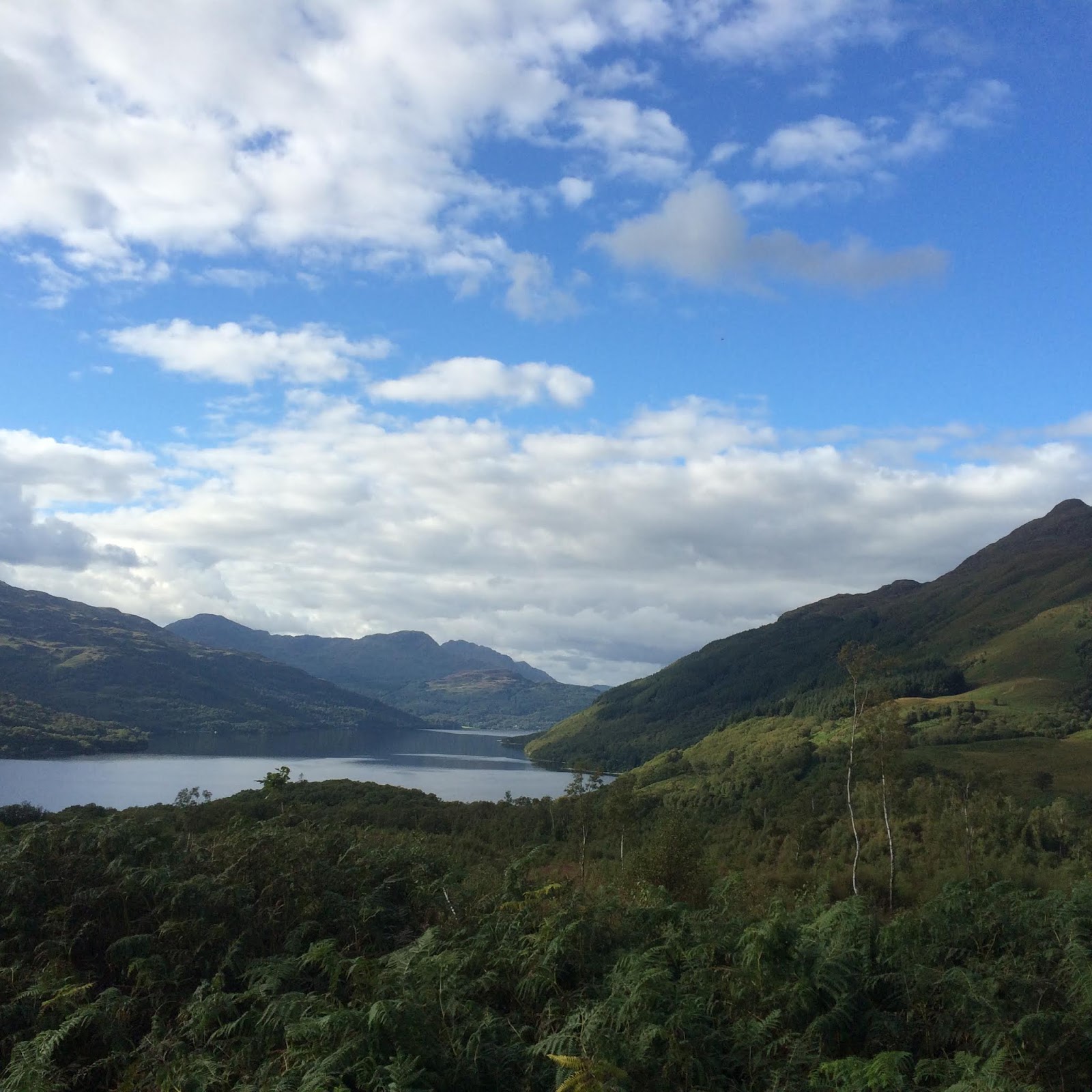
Loch Lomond from Ben Lomond
Location: An hour from Glasgow
Website: "Camping in the Forest" website - Cashel Campsite
Map: Google map
Camping Facilities: Car camping
Grade: C+
Stargazing: Very good
Summary: No caravan? Sleep in the ditch.
Thoughts:  Before I get into my review of the campground, I need to talk about midges. This was the first place I ever camped in Scotland, having wanting to see Loch Lomond ever since I first heard John McDermott crooning about her bonny shores when I was wee. But the Irish Tenor never paid sufficient tribute to the Highland midges. To be honest, I had been warned of midges, but didn't think much of them because, you see, I'm from Canada and we have mosquitoes the size of ravens, stalking around our campgrounds, and dreaded black flies that carelessly tear your flesh as they finish feasting on your delicious circulatory fluid. Clearly nothing can compare to these. I mean, really, how bad can a tiny flying flea really be? Listen Canadians, they're bad. They're really bad. They're actually horrifyingly bad. They're relentless, they don't fear the sunlight and they strike in swarms when you're tired & sweaty and simply trying to reap the rewards of your arduous hike! We got halfway up Ben Lomond on a beautiful late summer (mid-Sept) day and were stunned. Just as I was snapping a few photos, they descended with their fury, a dozen tiny, itchy pin-pricks all at once, never pausing for a moment's mercy. Then they'll itch for a good day or so. So be warned - bring some DEET or bring some meshy hats. Cover your skin as much as you can bear. Otherwise, take shelter.

You can camp on the verge if you don't have a caravan
Okay, enough about midges, on to the review of Cashel campsite. First, it's very conveniently located, just off the main road to Ben Lomond. I noticed a lot of people complain about the quality of the road leading up to it, but truth be told, I don't recall it being that bad. We pulled up and tried to track down the person responsible - the office closes a bit earlier than I'm accustomed to, and I believe we caught them right at the end of their shift (I think it was around 5ish). I was a bit taken aback when we were told where to camp at Cashel campsite. "You can set up anywhere on the grass there". "There" being the grassy median between the roads in the campground. Adjacent to the toilets and wash-up area. Convenient, yes. Pleasant? No. I definitely felt like a second-class citizen (resident?). Yes, it's true, we didn't have a camper van or a caravan or whatever you want to call it. But we're still human beings.  I mean, the campground itself couldn't be more beautifully situated along Loch Lomond. But if you don't have a vehicles that gets 2 miles per gallon, you cannot by any means sleep next to the Loch? It's a bit odd. I would have thought we would be rewarded for having versatile accommodations that can be plopped down anywhere we can squeeze. But the nice sites are for the folks who camp with kitchens and duvets, I'm afraid.

A handy map of the Ben Lomond hike
Look, I get it. A lot of the sites are rented seasonally by folks who own these homes-away-from-home. I know the site is not intended to preserve the natural environment or encourage low-impact camping. It's a business, with a first-come, first-served attitude for access to the prime waterfront campsites. But a tiny patch can't be reserved for the tourist who might be passing by, looking for a place to stay next to the beautiful lake nestled amongst the mountains?

I guess I'm just disappointed with it all. But it doesn't mean you can't find a nice spot to snap a few photos of the sun setting behind the mountains, casting a few golden rays on the lake (see below). You just can't fall asleep while doing.

Some final comments. The campground itself is in very good condition, where the toilets are spotless, the washing-up area is tidy and useful. Again, I noticed on the reviews on their website that a number of people thought the toilets were shocking. It may just be a matter of differing standards, but I thought they were quite good overall. Plus the setting is absolutely gorgeous - this on its own is a good reason to stay. The hiking close by is also excellent, with many beautiful views available (see the map provided here for some inspiration for Loch Lomond). My only major complaint is that better accommodations should be provided for campers who sleep on the ground, rather than on beds.


"The steep, steep sides of Ben Lomond"
Sunset over Loch Lomond


Monday, January 23, 2017

Review: Badrallach Campsite, near Ullapool, Scotland

A site on the Badrallach campground
Location: 45 minutes from Ullapool
Website: Badrallach 
Map: Google Maps
Camping Facilities: 
Bothy, campsites, and cottage
Grade: B
Stargazing: Very good
Summary: Beautiful location, simple facilities, sloped spots for tents, watch for midges
Thoughts: We had been driving all day, not really sure where we would end up when we did our internet search and found Badrallach Bothy. The Guardian informed us that this was one of the best campsites in the UK - to that point this was damning with faint praise (keep in mind my being accustomed to Canadian camping). But after considering it a bit, it seemed like everything we would want; close to the ocean, remote, and a genuine Scottish camping experience. I can say that we were not disappointed, by any standard of campsite.

The string of sites at the campground
(bothy in background)
We pulled up and knocked at the cottage located on site, and asked about a campsite. The price (£7.50 pp per night; Sept 2015) seemed reasonable and the setting looked fantastic. You drive in on a undulating, narrow road dug into side of the hills. It is a phenomenal spot and you get a sense of excitement to think that you're going to sleep rough in a place like this. You are tucked into the side of the hill, which doesn't afford the grandest of views, but you can look up the side of the hill to look at the heather (in the autumn at lesat) and a little waterfall that trickles its way down the slope. In addition, you can walk to the bottom of the hill on the main campsite and stroll down to the seashore and catch a good view of inlet, especially if the weather is clear.

One of the more secluded walk-in sites,
just a few steps from the main camping area
The campsites themselves are green and grassy, but the ground is generally sloped which can be create a bit of a challenge if you're trying to stay comfy in a sleeping bag. We were really impressed with the walk-in sites, which had a very private feel to them. We didn't feel like lugging our gear and setting up on one and I seem to recall the firepits being a bit better in the main camping area (though overall, they're still not great and you need to bring your own wood). The amenities (washing up facilities, washroom) are shared with the occupants of the bothy, which is fine and we had a few friendly chats with the occupants. The facilities were all in good order and sufficient for the small crowd that we had sharing the plots with us that day. The Badlarrach website suggests that the bothy becomes a common social/eating area for campers if it isn't reserved for sole use, but we did not have the pleasure of using it for that purpose.

We were visiting in Autumn, so I must warn that the midges were out as a merciless force; I suppose the midge buster was down for the season. However, as you can see from the photos, the site merits a look (just be sure to put on a midge hat). A great spot to begin a drive up the west coast of Scotland.


The setting of Badrallach Campsite
View from the nearby shore
(20 mins walk from campsite)
You mostly only share the landscape
with the sheep 


Monday, August 29, 2016

Review: Rossport Campground, Rainbow Falls Provincial Park

View from one of the spectacular waterfront sites
at Rossport Campground
Location: 2 hours E of Thunder Bay; 5 hours NW of Sault Ste. Marie
Website: Ontario Parks 
Map: Google
Camping Facilities: Frontcountry / Car Camping
Grade: C+
Stargazing: Good
Summary: Some nice car camping with lake-front campsites, even though it's right on the highway.
Thoughts: Well it served me right for not doing too much research. I had planned to do some backcountry camping in Sleeping Giant PP, so that I could spend the afternoon enjoying its fantastic hiking trails. It turns out that the backcountry camping required a substantial chunk of hiking just to get set up. In fact, from what I could see, it was a 5 km hike just to get into the sites (I've included the backcountry map below - I really wish that Ontario Parks would post these on their website!), which was too far for one night IMHO. So I had to bail on my camping plans and settle for the bumpy drive up to the lookout over Thunder Bay (which is unreal! you have to check it out!).

A nice spot to stargaze if the skies cooperate

So I did the 2 hour drive down to Rainbow Falls instead, and it was a good thing as it would have been pretty miserable drive to Lake Superior PP the next day if I hadn't. I arrived pretty late at Rainbow Falls, getting close to supper time. I had the choice between the Rossport Campground (which is right on Lake Superior) and the Whitesand Lake Campground. So essentially, your choice is a view over shrubbery or a view over Lake Superior - it's an easy one to make. I drove around Whitesand just in case there were some nice ones that actually overlook the lake, but couldn't find any (at least, none that were available), so I just headed back to Rossport.

First lookout on Rainbow Falls trail
The check-in at the gate was typical Ontario Parks - friendly, helpful, trying to make sure you get the camping experience you're after. At both gatehouses they insisted that I roam around and have a look for a site that I like best. (Aside: this is something that will only happen in less busy parks - in Bon Echo or Pinery, you pretty well take what they have, because your site will probably be gone by the time you get back to the gatehouse). Highway noise is again an issue, but that's the price of convenience. I mean, pulling over and camping next to Gitchigumi with no reservation in peak of summer for about $40 - you can make do.

Sure, it's loud but a primo seat for
watching thundering water
A few of the sites afford a fantastic view of Lake Superior as they are right on the shore; but I must say, there are only about 4 high quality sites, and the campsites that are not adjacent to the lake were not very good. Even still some of the sites next to the lake were not actually on the water - in fact, the lake wasn't even accessible for a few of these. However, many of those sites had good under story for privacy though astoundingly, these were sometimes positioned directly across from one another (hello privacy...so long privacy).


Blueberries in various
stages of development
Rainbow Falls -
photos do not do it justice!
The following day I ventured up to the hike to Rainbow Falls (fantastic) in the Whitesand Lake campground, followed by the two lookouts (which were well worth it, mainly because of all the wild blueberries near the lookouts!). I recommend the hikes, the thundering water of Rainbow Falls takes no time to reach and will keep you entertained for a while (especially if try out your best Ansel Adams impersonation).


Sleeping Giant Backcountry Hiking Map
Backcountry map of Sleeping Giant Provincial Park
(circa 2015)

Review: Fenton Lake, Lake Superior Provincial Park

View South from Fenton Lake Campsite,
a few hours after sunrise


Location: Fenton Lake, Lake Superior Provincial Park
Website: Ontario Parks or Friends of Lake Superior PP
Map: Friends of Lake Superior PP or Google Maps
Camping Facilities: Backcountry
Grade: C
Stargazing: Decent
Summary: A serviceable last-minute backcountry option, but not a reflection on the quality of the park - highway noise is an issue
Thoughts: It was getting late by the time I arrived in Lake Superior, on my way back from my first trip exploring the true "up north" in Ontario. I had the chance to explore Thunder Bay with some old friends and have a peak at Quetico, so I was happy to return to Lake Superior PP for a relaxing evening. As I've said in my other posts, Lake Superior is my favorite Ontario park, mainly because of its diversity of camping opportunities and the unparalleled beauty of its shoreline.

The single campsite on Fenton Lake
There were a few options available to me; I could stay at Old Woman's Bay at the backpacking site on its shore; I could try one of the car camping sites at Rabbit Blanket Lake campground; or I could backtrack (never a desirable option) to Fenton Lake or one of it's interior lakes. Old Woman's Bay was available but looked far too conspicuous for my liking - your tent would be in clear view of anyone who came to visit it's spectacular shores (but yes, Old Woman's Bay is hard to beat for a lunch stop or picnic). Rabbit Blanket Lake's sites were decent, but nothing too exciting (not scenic in any way, but decent privacy). But I didn't know much about Fenton and wasn't sure if it was worth it. I consulted a member of park staff at the Rabbit Blanket Lake gatehouse. We had a chat about the park in general, how underused it was, and how even the summer staff (mostly university students) didn't do very much exploring on their days off. While she hadn't been up to Fenton herself, she said that I'd have it all to myself as nobody else had registered there that night, so I decided to go for it.

Fenton Lake Put-In
By the time I put in at the end of the 500 m downhill, well-maintained portage (score!), it was nearly 6 pm. I decided that it wasn't worth the trip into one of the deeper lakes (Treeby, Shakwa, Junction or Underhill). In hindsight, if I had given myself more time, I would have.

Transport truck roaring by Fenton Lake
Fenton is a narrow lake, especially by the campsite (there is only one site), which means your view of the sky is mostly obstructed. The bigger problem is that the highway is aligned parallel to it, with traffic clearly audible from any site, especially the big rigs. Late at night, when the traffic dies down and the fire is crackling, you can nearly ignore it. The highway noise was mostly gone by 10 pm, and it's peaceful enough that I could hear the sound of a duck taking off on the other side of the lake. But if you're trying to get some peace and pretend like you're actually in the deep woods, Fenton Lake is a bummer. The big rigs just don't really ever stop. Plus I had a hard time finding a flat spot for the tent, and the site itself isn't terribly scenic. It's main saving grace is that there is a beautiful old white pine tree out front.

Not much beats a big stack of firewood
with an hour to spare before dusk
But it's not all bad news. For the anglers - the fish were constantly jumping 2 hours before sunset so I think you might have some luck there. For the swimmers, the water was calm and warm, so you might enjoy a dip. For the campfire lovers, there is so much firewood around the site. As well, there are beautiful hills surrounding the lake. Other than the highway, the lake is very peaceful (cause you'll be the only person on it). Important to note that interior sites are not reservable in Superior PP,  but they are mostly available due to low attendance.


Fenton Lake Canoe Route Map Lake Superior Provincial Park
Canoe route map for Fenton Lake -
erected during Ontario Parks' glory days
Some pointers from the MNR


Saturday, March 26, 2016

Review: Pickerel Lake, Quetico Provincial Park

Location: 2 hrs West of Thunder Bay
Website: Friends or Ontario Park
Map: Google
Camping Facilities: Backcountry (Wilderness)
Grade: A+
Stargazing: Didn't have the good fortune, but probably pretty good
Summary: Wish I had more time...
Thoughts: I remember the first time I heard about Quetico, back in 2001, calling up the Ontario Parks reservation line and being told that "a $100 deposit was necessary for any bookings" in the park. I remember thinking "Where? Why?". It seemed odd that this random park needed an arbitrary deposit fee, but there must have been a good reason. That reason is still a mystery, mainly because I've never bothered to ask anyone up until this point. But I did look up the park to see what all the fuss was about and it is an enchanting concept: imagine a park that's about half the size of Algonquin park, where logging activities are strictly forbidden (i.e., no false vistas for the paddling thoroughfares like those found in Algonquin), where motorboats are not welcome, where the current natural state is preserved in perpetuity, where there are no grandfathered resorts in the interior, where the campsites are unmarked, where the portages are unsigned, and where you can cross the Canadian-American border by canoe. It all sounds like what a backcountry park should be. But this is one of the few in the park system where all this is true.

The call of a calm bay is hard to resist on Pickerel...
I had myself one night to check out Quetico. One night - 400,000ha. Needless to say, you can't even scratch the surface. And it had to be somewhere that wouldn't crush us in our attempt to access the park in the midst of a fierce late-summer storm. Plus it had to be a reasonable drive from Thunder Bay. It's limiting, to be sure, and our first pick (Baptism Creek - a fitting name for one's first foray into the park) was not taking any new campers that night. So we took the next best thing in Pickerel Lake. It's a 30-minute drive off the Trans-Canada, down a pretty sketchy road, till you're finally at the Pickerel Lake parking lot. Then you have to do a long 500m portage. I say "long" because it's one of those ones that feels a lot longer than what's marked for some reason. It's narrow and rocky, plus I found some folks on the trail less than respectful of portage etiquette (the person with the canoe on their head has right of way, people). It's also pretty mucky, but staff do their best to keep your boots clean with some boardwalks. Note: there is no park office on this road, so you'll have to check in at the park pavilion / car campground. The pavilion is probably worthwhile stopping for in itself, one of the nicer park gatehouses I've seen. Nice facilities too.
A panorama of Pickerel
Pickerel Lake is a monstrous, wind-whipping East-West lake. All the canoeists we met on the lake were raring to go and we all smelt a whiff of competition in the air as the sites are first-come first-served. More so than in the Algonquin or Killarney spirit, because there's no guarantee a good, clear campsite will be waiting for you (at least in those other parks, you book a spot on Big Crow Lake, you know you have a spot on Big Crow Lake). There a quota systems in place which limit the number of people in the backcountry, so there's probably no reason to worry that you won't find anything good; plus seeing as you can technically camp anywhere, well, all  you need to find is an open flat-ish piece of ground.

We set off into strong gusts that nearly swamped us within the first 15 minutes; they slowed our progress to a crawl as we tried to make our way east into the Lake. Our fellow canoeists were off to the races, everybody seemed to know what they were doing and where they were headed. We fell to the back of the pack and quickly realised that if we wanted to enjoy what was left to enjoy of the day, we had to take the first campsite that we could get. After two false stops (they looked like sites from the water, but on shore they were not worth unloading for), we found a keeper. And it was a pretty nice one to be sure, but that's the trick of unmarked campsites - you never know where the next one is and if it might be a bit better.

Nothing beats knowing you have
a good stack of firewood
Our site was full of dead fall, even though it was on a narrow point with sparse tree cover. The bugs were kept at bay and we were able to enjoy a roaring fire for 6 hours while we polished off a bottle's worth of bourbon (no bottles or cans allowed!). There are no picnic benches, no privies, no firepits with accompanying grills. It's all as basic as camping gets. Sometimes it left me wanting, but the benefits outweigh any of the strikes against. Oh, and contrary to what my ignorant Southern Ontario brain guessed - yes, you do get leeches in lakes up north. So watch where you're swimming, a number were trying to make a meal out of my canoe (nice try, jerks).

Quetico Provincial Park
Endless wilderness...
I can't recommend a trip up to Quetico enough. It's the true canoeists mecca in Ontario, maybe Canada. The setting is magical, mainly because you know that it just goes on forever and that it's as pristine a spot as you'll find this far south in the province. The promise of all the countless wilderness lakes, pictographs, old growth forest, giant white pines, waterfalls, and human history that reach far beyond big Pickerel Lake's treeline, it's enough to blow one's mind. Support our great Northern Ontario parks and don't worry about the $100 deposit.


Friday, February 12, 2016

Review: Hattie Cove Campground, Pukaskwa National Park

Playter Harbour, Coastal Hiking Trail
Location: Hattie Cove Campground, Pukaskwa National Park
Website: Parks Canada
Map: Parks Canada
Camping Facilities: Car Camping
Grade: B
Stargazing: Good by the Lake
Summary:Average camping enhanced by being close to glorious Lake Superior and pristine forest setting
Thoughts: The plan was to make my way along the Trans Canada highway towards Thunder Bay, aiming to meet up with some friends along the drive for some camping. I originally had Slate Islands Provincial Park in mind, after reading this article about it's dense elk population (imagine having elk roaming through your site). I was stoked, but then I found out it would cost $500 for a return shuttle from Terrance Bay. Split between 6 couples for one week, you could make a strong case for it. But with just 3 people staying only one night, it would be a total waste. So my friends suggested Pukaskwa (pronounced Puck-a-Saw, as I quickly found out). I had been meaning to see it for quite some time, and figured that it's a low-stress option to enjoy the company of old friends whom I hadn't seen in a while.

Lookout over Halfway Lake
The camping itself was just okay. Some sites are a little more private than others; you'll find that some are inexplicably directly across from one another, with only your cars to provide the necessary screen to avoid any awkward eye contact. But a few sites are large and pretty private. I wanted to see 48, which is a bit off the road and sits next to Halfway Lake, but it was occupied and I was told it's a bit buggy (you can see in the photo on the right that Halfway Lake is a bit swampy). Site 46 would be a winner if it weren't clearly visible from the path to the comfort station. Speaking of which, the comfort stations in the park are clean and comfortable. And as with all National Parks, you pay twice - the entrance "day-use" fee and the camping fee - which I find a bit irritating, but it still ends up being cheaper than car camping in Ontario Parks (by about $3 - 2015 fees). The park staff I dealt with were really thoughtful and allow you to take a drive around to see what site you like best, then register after you've had a gander. You're likely to find something good, but yea, nothing special.

Middle Beach, with it's piles of driftwood
But putting the camping aside, the setting of the park itself is phenomenal. Just a short 5 minute walk from the campground, you're on Lake Superior, with its thunderous waves drowning out any thoughts of the real world that might have followed you on your trip. You could stare at the Lake for hours, watching it play Hot Potato with the beach, as the waves toss the driftwood to the beach and the beach rolls it right back. And at night you'll find that the Middle and North Beaches (probably Horseshoe Beach too) are spectacular for stargazing. The day hikes to Manito Mikana, Horseshoe Beach, and the Southern Headland Trail are all well worth the trip and you'll be entranced by the vistas. I thought the lookout over Halfway Lake (above) was worthwhile (just after you start a counterclockwise tour from the trailhead), but the rest of the hike looked a bit boring so I skipped it. Please correct me if I'm wrong.

Boardwalk at the beginning of the
Pukaskwa Coastal Hiking Trail
The highlight of the park is the Coastal Hiking Trail. With its many campsites and nearly pristine Lake Superior coastal scenery, it is a worthy adventure. There is justification for the use the word "pristine", as you can see from this map that Pukaskwa is one of the last remaining intact forest landscapes in the southern half of the province, as discovered by the IFL mapping team. I was only able to hike to the first campsite, but even that one (Playter Harbour) was something to behold (top of the page here). The backcountry site itself was really spacious, with an outhouse, fire pit and food locker. I'm curious about the other sites, as they contain up to six individual sites - are these clustered together? Or are they somewhat private? Please comment below if you know. As well, I should point out that the trail is well marked and easy to follow, but would be very slippery in spots after a bit of rain.

Lookout from Southern Headland Trail
I'd love to come back and at least make it to the White River Suspension bridge, but it's a full day hike (leave before 10am). A fellow hiker informed me that he wanted to do a one-way hike and get a shuttle back from the North Swallow river, but the guiding company was going to charge him $500 for the trip back so he just walked the whole stretch in a return trip (solo no less!). What is it with $500 shuttling fees in this part of the province? Regardless, Pukaskwa is worth your effort because it's just a beautiful spot - the camping is a means to discover the splendor of this unique wilderness refuge.

Food locker on the
Coastal Hiking Trail
Outhouse on the Coastal Hiking Trail


.